Completed Projects
A CONTINUED COMMITMENT
Building upon the foundation of water resources management and environmental protection, the Fox River Commission will continue to assist communities to maintain the middle Fox River as an asset for the people of Southeastern Wisconsin. In fulfilling their mandate, the Fox River Commission continues to build partnerships with communities, organizations and municipalities.
Most recently, the Fox River Commission, in conjunction with the Southeastern Wisconsin Regional Planning Commission (SEWRPC), has updated it's Implementation Plan to reflect it's current goals and objectives.
Commission Chair: Alan Barrows
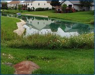
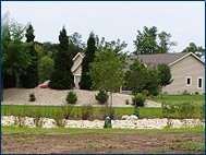
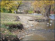
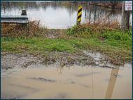
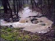
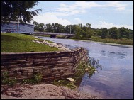
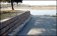
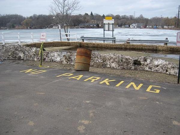
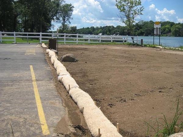
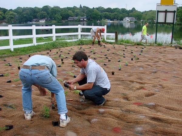
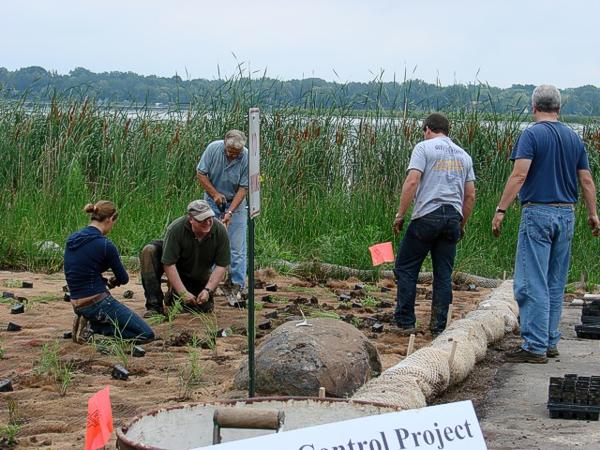
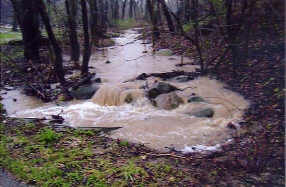
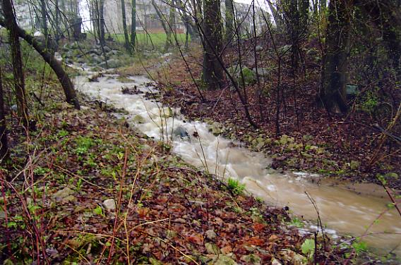
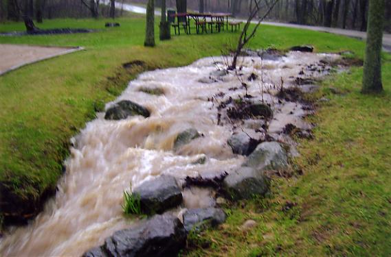
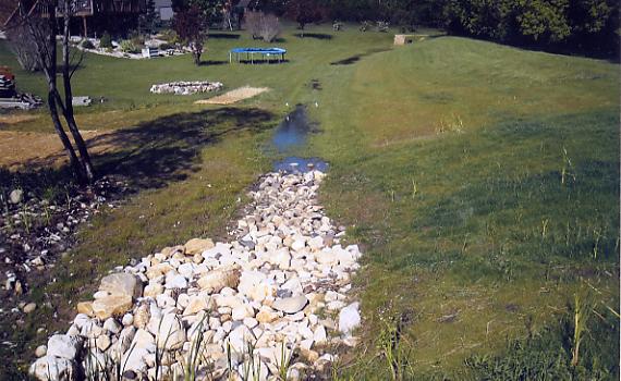
BIG BEND LIONS PARK
Lions Park in the Village of Big Bend, Waukesha County, is the site of both past and proposed future projects of the Fox River Commission.
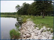
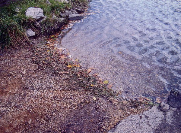
Streambank Protection
During 2002, the Fox River Commission partnered with the Village of Big Bend to install streambank protection along the parkland shores. The two-phased project was completed in December 2003. The project cost was $25,000.
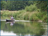
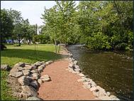
Proposed Canoe Launch
Lions Park in the Village of Big Bend is a popular launch and retrieval site for canoeists from throughout Southeastern Wisconsin. During 2007, the creation of a canoe launch was proposed as a means of facilitating access to the River from the Park. This project was scheduled for implementation during 2008 at a cost of about $30,000.
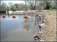
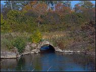
FOX RIVER INN
The site of the former Fox River Inn in the Town of Vernon, Waukesha County, was an area identified for the placement of erosion protection in the Fox River Commission implementation Plan.
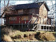
Land Acquisition
During 2002, the Fox River Commission partnered with Waukesha County to demolish the structure and place streambank protection along the shores. The structure was removed during 2002 at a cost of $200,000.
Streambank and Habitat Protection
Shoreland protection, including streambank plantings, was installed during 2003 at a cost of $10,000.
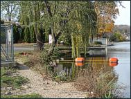
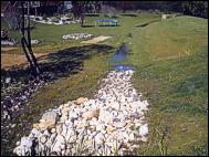
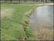
GOLDEN BAY
Stormwater management basins form an integral part of the stormwater management practices used by communities throughout Southeastern Wisconsin.
Stormwater Basins
During 2004, the Fox River Commission partnered with the Town of Waterford in Racine County and the local residents' association to rehabilitate the stormwater basins serving the Golden Bay subdivision in the Town. The project was completed at a cost of $50,000.
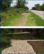
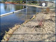
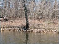
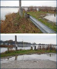
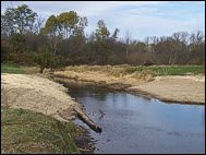
LANGMESSER PARK
The principal boating channel of the Fox River makes a westward bend in the Town of Waterford, Racine County, paralleling Bridge Drive, prior to entering the Tichigan State Wildlife Area and the Waterford Impoundment.
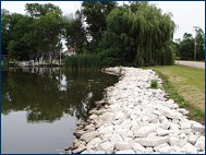
Shoreland Protection
During 2002, the Fox River Commission partnered with 15 riparian property owners to install shoreland protection along this shoreland at a cost of $68,000.
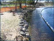
FOX ISLE
Fox Isle Condominium development.
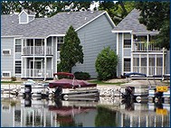
Shoreland Erosion Control
During 2002, the Fox River Commission partnered with the Village of Waterford, Racine County, to control shoreland erosion around the Fox Isle development. This shoreland protection project was completed at a cost of $50,000.
BEACH DRIVE
Stormwater management basin.
Stormwater Pond
During 2002, the Fox River Commission partnered with the Town of Waterford, Racine County, to maintain the stormwater management basin at Beach Drive. This basin had reached the end of its design life and required extensive renovation, which was carried out at a cost of $10,000.
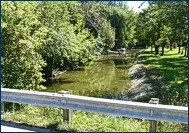
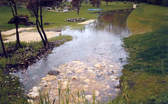
STATE HIGHWAY 164
The creation of the Waterford Waterway Management District (WWMD), a public inland lake protection and rehabilitation district, formed in 2002 by the Racine County Board of Supervisors under Subchapter IV of Chapter 33 of the Wisconsin Statutes, in response to the petition of the riparian property owners, has provided an additional vehicle through which the citizens of the Town and Village of Waterford are seeking to maintain, protect and enhance their environment. Since its inception, the WWMD has sought to establish partnerships with both civic organizations in the Waterford area, including the Fox River CAUSE, a citizen-based nongovernmental organization, and governmental bodies, such as the Fox River Commission.
Rain Gardens
During 2007, the Fox River Commission and the WWMD joined forces in the conduct of a runoff management project that included the construction of "rain gardens" on properties upgradient of Tichigan Lake in the Town of Waterford, Racine County. Rain gardens are designed to minimize runoff from specific sites through infiltration.
Swales
In addition, certain modifications were implemented within the swale along STH 164. These modifications are designed to slow the flow of water within the roadside ditches, minimizing erosion, and reducing the movement of pollutants to the Waterford Impoundment. The Fox River Commission contributed $45,000 toward the completion of these initiatives.
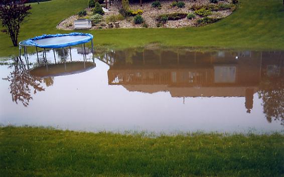
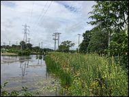
ISLAND VIEW BAY DRAINAGE IMPROVEMENT PROJECT
Similar to the State Highway 164 project, the work involved multiple ditch dams, major ravine riprapping, and the installation of stilling basins. Shoreline filtration plantings were accomplished through the District's Rain Garden Grant Program.
MUKWONAGO INDIANHEAD PARK SHORELINE STABILIZATION
The Mukwonago River is among the cleanest and most biologically diverse streams in southeastern Wisconsin and provides critical habitat for a number of rare, threatened and endangered species of fish and invertebrates. Years of fishing and swimming at the park have caused severe erosion to a long stretch of the shoreline, and have degraded the habitat and spawning grounds for a number of these aquatic species.
Before
This 2008 initiative was intended to stabilize a 500 foot section of shoreline along the pristine Mukwonago River at Indianhead Park. The project team developed construction plans for the implementation of bioengineering techniques that will not only prevent further erosion, but will also preserve and create new wildlife habitat.
After
The first technique that was implemented was multiple rows of coir fiber logs along the shoreline. These logs consist of tightly wound coconut fiber in lengths up to 20 feet that are contoured to the shoreline and staked in place.
Before
In severely eroded areas soil fill was placed behind the logs to recreate a more natural shoreline. The fiber logs were planted with plugs of native plant species that are found naturally along the Mukwonago River. The native plants have extensive root systems that will spread down through the fiber logs and into the soil and river bottom.
After
Eventually the fiber logs will degrade but the plants and their root systems will remain to stabilize the shoreline and prevent against future erosion. The vegetation will provide habitat and a food source for both aquatic and terrestrial animals.
After
Because this section of the river is so popular for recreational use, river access was kept intact by providing several access points where the toe at the shoreline was reinforced with fieldstone boulders. These access points and the pathways leading to them were seeded with low growing native grass species that can handle foot traffic.
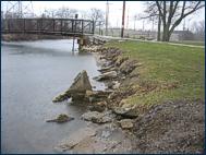
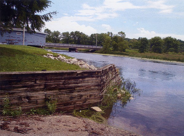
VILLAGE OF WATERFORD DAM & STREAMBANK STABILIZATION
The Waterford Dam and Village Hall Park Streambank Stabilization project was a joint effort of Racine County and the Village of Waterford. The shoreline above and along side the dam needed shoring up and streambank erosion due to swelling below the dam needed repair.
Before
The shoreline above the dam was eroding and trees were threatening boat launching and fishing by potentially falling due to the erosion.
After
This reverse angle view shows trees removed and shoreline protected with riprap and seeded plantings.
Before
Streambank erosion in Village Hall Park was taking it's toll on the shoreline near municipal buildings as well as making river access dangerous for fisherman.
After
Trees too close to the water's edge were removed, riprap and natural plug plantings were placed to protect the shoreline and several access points were installed to enhance the use of the park and the river.
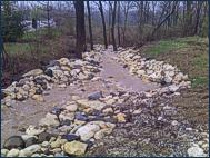
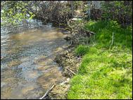
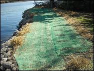
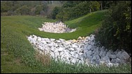
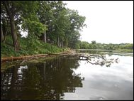
SCHMIDT & CATON ISLAND EROSION CONTROL PROJECT
This is an educational project comparing four different types of shoreline erosion control methods against one another when placed next to each other in 25 foot sections. The methods compared are Rock Riprap, Coir Fiber Blocks, Biologs and BioDMat 40. Over time we will collect data that will show us which method of erosion control was the most effective.
Rock Riprap
Rock Riprap was installed by barge as ice conditions did not allow heavy equipment.
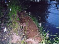
Bio-Material Products
Coir Fiber Blocks, Biologs and BioDMat 40 methods were installed as an alternative to the riprap. All methods included plantings with native root stock.
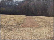
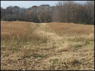
PHANTOM WOODS ROAD ENHANCEMENT PROJECT
The Town of Mukwonago has identified a significant stormwater-related erosion concern affecting the channel linking Upper Phantom Lake and Lower Phantom Lake, on the Mukwonago River tributary to the Fox River.
Before
Phantom Woods Road slopes steeply to the lakeshore, with the result that pollutants, including particulates such as sand and gravels, are transported into the Lakes and ultimately into the Fox River system, as can be seen in the images below.
Shoreland Buffer Strip Proposed
It is proposed that the road end, which currently abuts the channel between Upper and Lower Phantom Lakes, be pulled back from the channel to provide for an expanded shoreland buffer strip.
This area would be restored utilizing native vegetation designed to minimize the delivery of sediment and other contaminants to the Fox River system while increasing diversity of habitat appropriate to this shoreline.
Biologs are proposed along portions of the stream bank to reduce further erosion.
After
The road phase of the project was completed in the fall of 2009. In early spring of 2010, DNR and County Permits were required for the preparation of the 40' vegetative buffer zone.
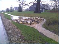
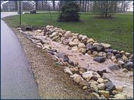
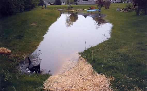
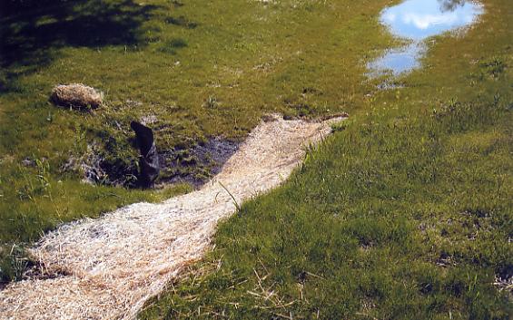
IDLEWOOD DRIVE STORM WATER ABATEMENT PROJECT
Completed in late 2009, this project remediated upland flooding in a drainage easement and reduced the velocity of out flow through a steeply-sloping ravine. Five natural rock check dams and stilling basins were installed in a wooded conservation area. Total project cost was $52,926.
The Problem
Property owners along Idlewood Drive, Joy Marie Lane and adjacent to the wooded ravine of the Hidden Harbor subdivision, were aware of upland flooding and the onrush of storm water into Tichigan Lake that occurs after rain storms. Property owners appealed to Racine County and other agencies for a solution.
View more photos of "The Problem"
The Solution
Storm water regularly floods and ponds before draining into the ravine and down into the lake. This condition was relieved by the installation of a biofi1tration settling basin. The basin will be totally below grade and is located within the existing dedicated drainage easement on affected properties. When completed and landscaped, it will not be visible to property owners or the public at large, serving to filter rainwater contaminates before draining into the ravine. View more photos of "The Solution"
GRAND DRIVE / BUENA PARK PROJECT
This project is located just south of Egg Island and due west of the three buoys which mark the rock beds. There is a tremendous amount of wave action from watercraft at this point, causing serious erosion along this part of the shore line. Adjacent property owners claim that erosion has washed away almost six feet of land over the years. Total project cost was $15,824 with a 90 - 10 cost share between SEWFRC and the WWMD.
The Problem
The piece of land involved is about 40 feet wide which and is a non-swimming Town road right of way. Today's high number of watercraft on the Fox River has created extreme shoreline erosion.
The Solution
The project consisted of having natural stone rip-rap installed at the shoreline with a ten foot native plant buffer strip behind the stone. On the upper portion of land there is a culvert that comes under the road and drains onto the land. At that point an area of natural stone was laid at the culvert outlet to slow the flow of run-off and to deter erosion. We now have a project that not only reduces an erosion problem, but improves the appearance of the area.
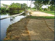
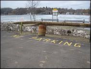
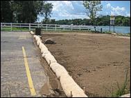
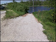
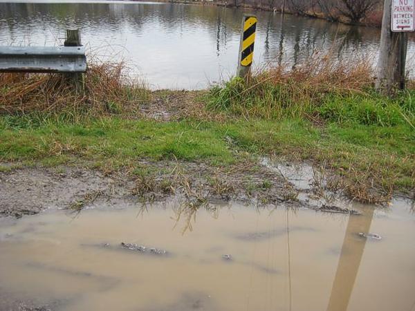
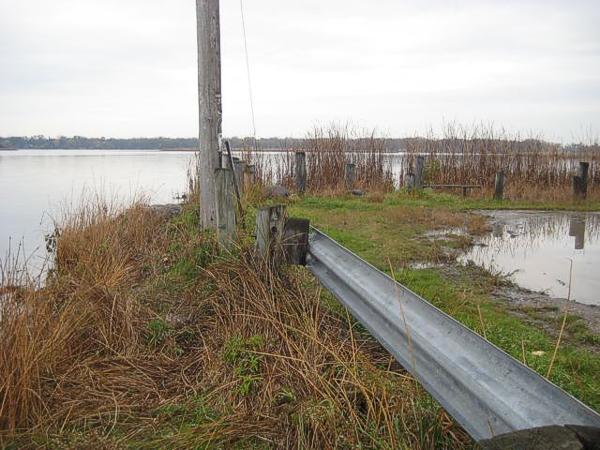
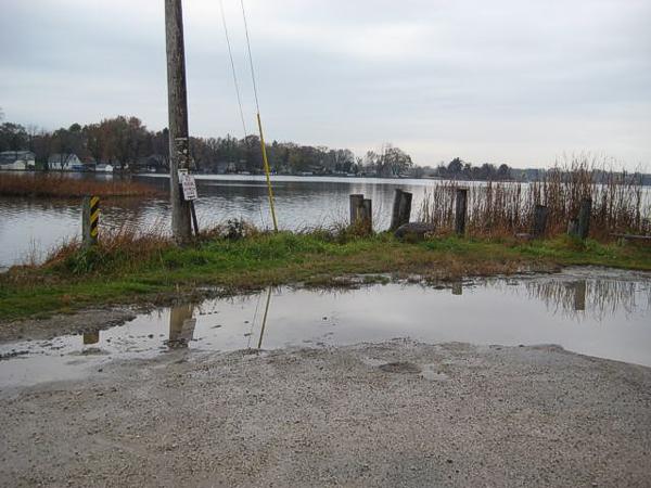
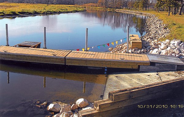
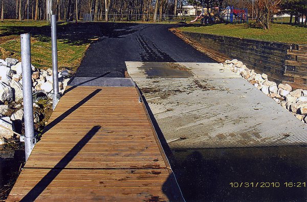
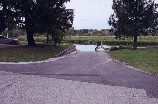
BIG BEND CANOE / BOAT LAUNCH
Lyon's Park in Big Bend is a popular access point to the Fox River. The park's canoe / kayak launch was in desperate need of repair.
The Problem
The launch had a deteriorating asphalt drive that made it difficult to back trailers in and was causing undesirable run-off into the Fox River.
View more photos of "The Problem"
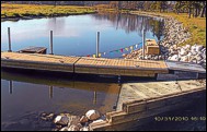
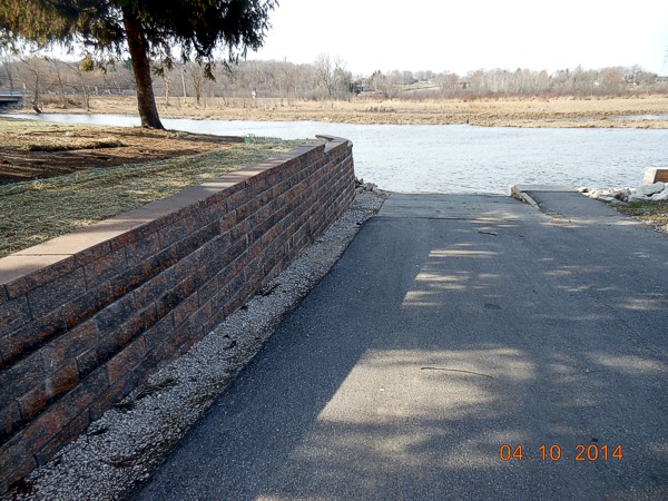
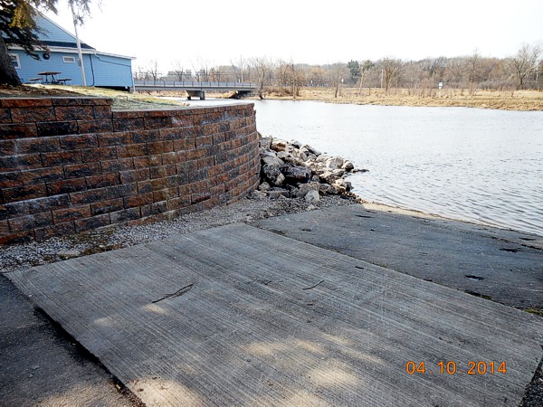
The Solution
The new design expands the launch to be more than just a canoe launch and now will meet depth requirements, river grade and launch guidelines as provided by the DNR. The new launch uses concrete planks surrounded by rip rap for stability. The Southeast Wisconsin Fox River Commission participated at a 90% - 10% cost share and contributed $54,742 toward the project.
View more photos of "The Solution"
Retaining Wall
After the launch work was complete the Village of Big Bend asked the Commission to participate in the reconstruction of the retaining wall that was crumbling away. The FRC participated again at a 90 - 10 cost share and contributed $10,050 to the project.
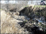
COUNTY HIGHWAY ES GULLY REPAIR PROJECT
This project involved repair of a popular Fox River access point for canoes, kayaks and small fishing boats.
The Problem
A significant eroded gully had formed in the northeast corner where National Ave. (HWY ES) crosses the Fox River in the Town of Vernon. The gully was a problem not only because it was delivering sediment to the river, but also was a safety hazard to people launching canoes and kayaks at a popular river access point.
The Solution
In a cooperative effort between the landowner, Waukesha County and the Southeast Wisconsin Fox River Commission, the shoulder along National Avenue was graded to reduce the amount of area contributing runoff toward the gully. Then the gully was repaired to prevent further soil erosion and withstand traffic from recreational users including snowmobilers. The Southeast Wisconsin Fox River Commission contributed $600 toward the project.
MILL CREEK DRAINAGEWAY IMPROVEMENT PROJECT
Mill Creek, in the Town of Waukesha, is a tributary to Pebble Brook, which is a tributary to the Fox River.
The Problem
In 2008 after heavy rainfall, a contributing drainageway to Mill Creek with a 200 acre watershed washed out under the high flow conditions. The eroded material ended up in Mill Creek and ultimately in the Fox River.
The Solution
An engineered plan was developed to construct a stilling basin, even out the drainageway slope, stabilize the drainageway with heavy rip-rap and stabilize an upper slope with a vegetated retaining wall. The grading and stabilization of the project area was completed in 1 week. The Southeast Wisconsin Fox River Commission contributed $20,000 toward the project.
FUTURE FOX BEND PARK PROJECT
A property owned by Waukesha County slated for becoming part of the future Fox Bend Park.
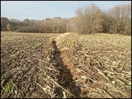
The Problem
A gully formed in a current crop field which drains directly to a Fox River tributary.
The Solution
A grassed waterway was designed and constructed to convey a steep 10 acre drainage area through the field, filter out sediment and prevent further erosion.
The Result
The grassed waterway includes a buffer on both sides planted with Wisconsin native prairie grasses. The Southeastern Wisconsin Fox River Commission contributed $4696.00 in cost-share funding to complete the project.
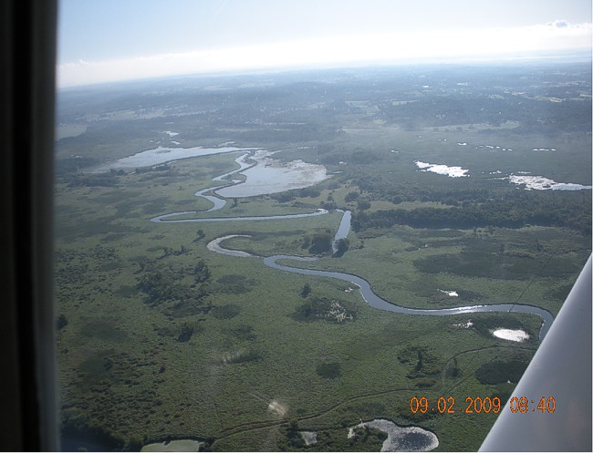
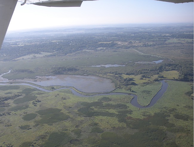
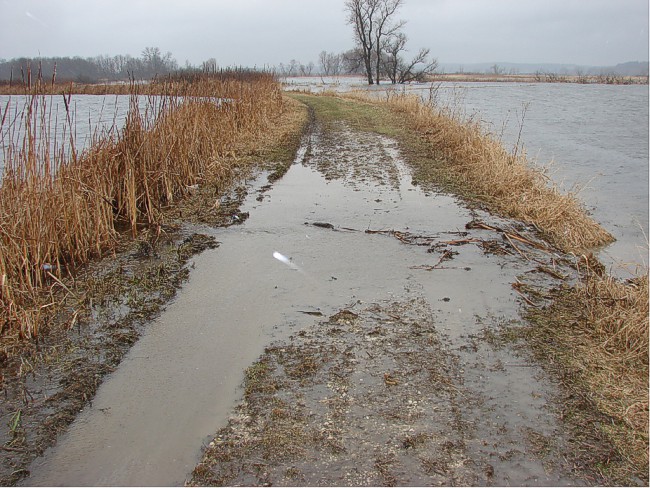
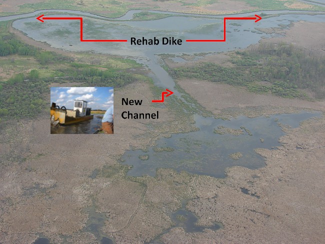
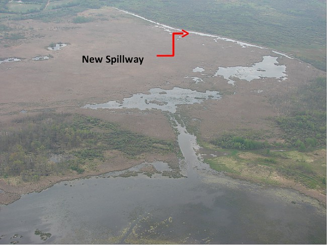
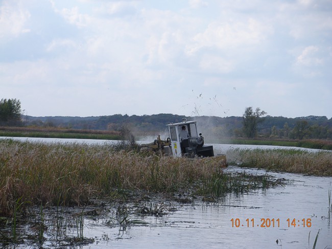
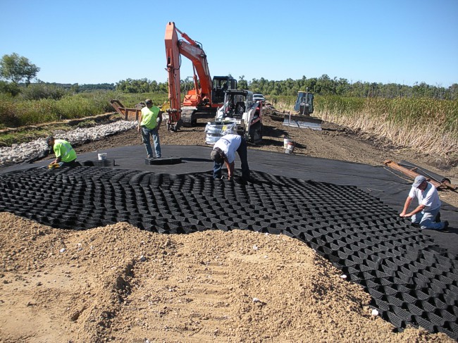
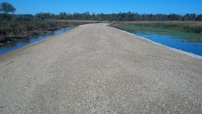
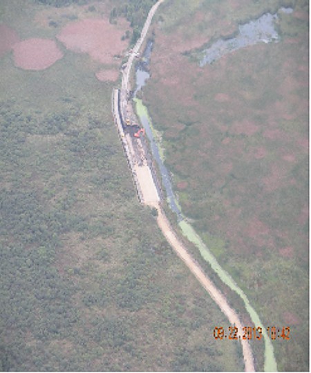
VERNON WILDLIFE AREA MAIN DIKE RESTORATION
Dike rehabilitation, new channel and spillway.
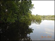
MUKWONAGO RIVER / RAINBOW SPRINGS PROJECT
When the Rainbow Springs Golf Course went out of business, the WDNR purchased the land so it could repair the Mukwonago River. The goal was to improve navigability, provide bank stabilization, enhance wildlife / fisheries habitat and protect and enhance water quality.
The Problem
Seven cross-culverts in the Mukwonago River obstructed flows, fish passage and navigation.
The Solution
The culverts have been removed, the riverbanks have been restored, navigation reestablished and fish passage is greatly improved. The Fox River Commission contributed $50,000 toward the completion of the project.
MUKWONAGO RIVER SHORELINE STABILIZATION
The north side of the Mukwonago River across from Indianhead Park was severely eroded.

Partnership
The project came together as a collaborative effort between the Fox River Commission, Village of Mukwonago, Waukesha County, the landowner and an ecological restoration company working together to stabilize the riverbank with bioengineering and native vegetation.
Restoration
The restoration was completed in 2017. The Fox River Commission provided $87,645.05 in funding for the project.
MUKWONAGO PARK SHORE RESTORATION PROJECT
The swimming beach at Waukesha County’s Mukwonago Park was experiencing shoreline erosion and occasional high bacteria levels from Canada Geese.
Before
Mukwonago Park was experiencing shoreline erosion and occasional high bacteria levels from Canada Geese.
After
The restoration was completed in 2017. The Fox River Commission provided $87,645.05 in funding for the project.
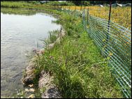
ROXY POND SHORELINE RESTORATION PROJECT
Riparian landowners were experiencing a significant loss of shoreline due to bank erosion caused by shade and invasive brush. Trees were falling into the water as the bank receded.
Before
Cost-share funding was provided to remove and manage the invasive brush which allowed for sunlight to reach the pond’s edge.
After
Biostabilization measures were implemented along the shore and WI native vegetation was planted in the upslope area. Trees in the water were left for fish habitat. The Fox River Commission provided $35,640 in cost-share funding.
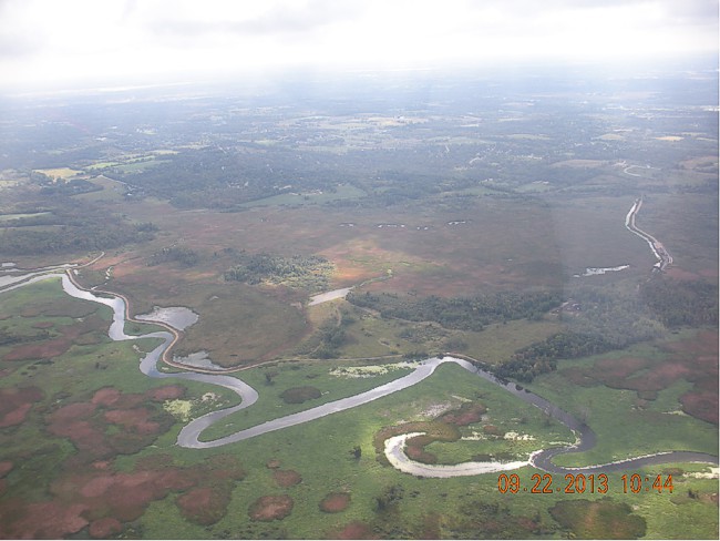
COMPLETED PROJECT LOCATION MAP
Select Blue Tabs for individual project identification.
View Completed Projects in a larger map.
Photos courtesy of:
Dr. Thomas M. Slawski, SEWRPC
Mark Jenks, Waukesha County
Steven Brunner, Ruekert-Mielke, Village of Mukwonago
Rebecca Ewald, Village of Waterford
Waterford Waterways Management District
Barb Holtz, Town of Mukwonago
Shelley Tessmer, Town of Waterford
Alan Barrows, Waukesha County